
MAP View
Renders every row as a marker on a map. The position comes from an EditType.MAP field or from a pair of numeric lng / lat fields; markers can be colored by a field and are clustered when zoomed out, and clicking one opens an info window with a link to the row. Used with @Vis(type = Vis.Type.MAP).
Supported in 2.4.0+
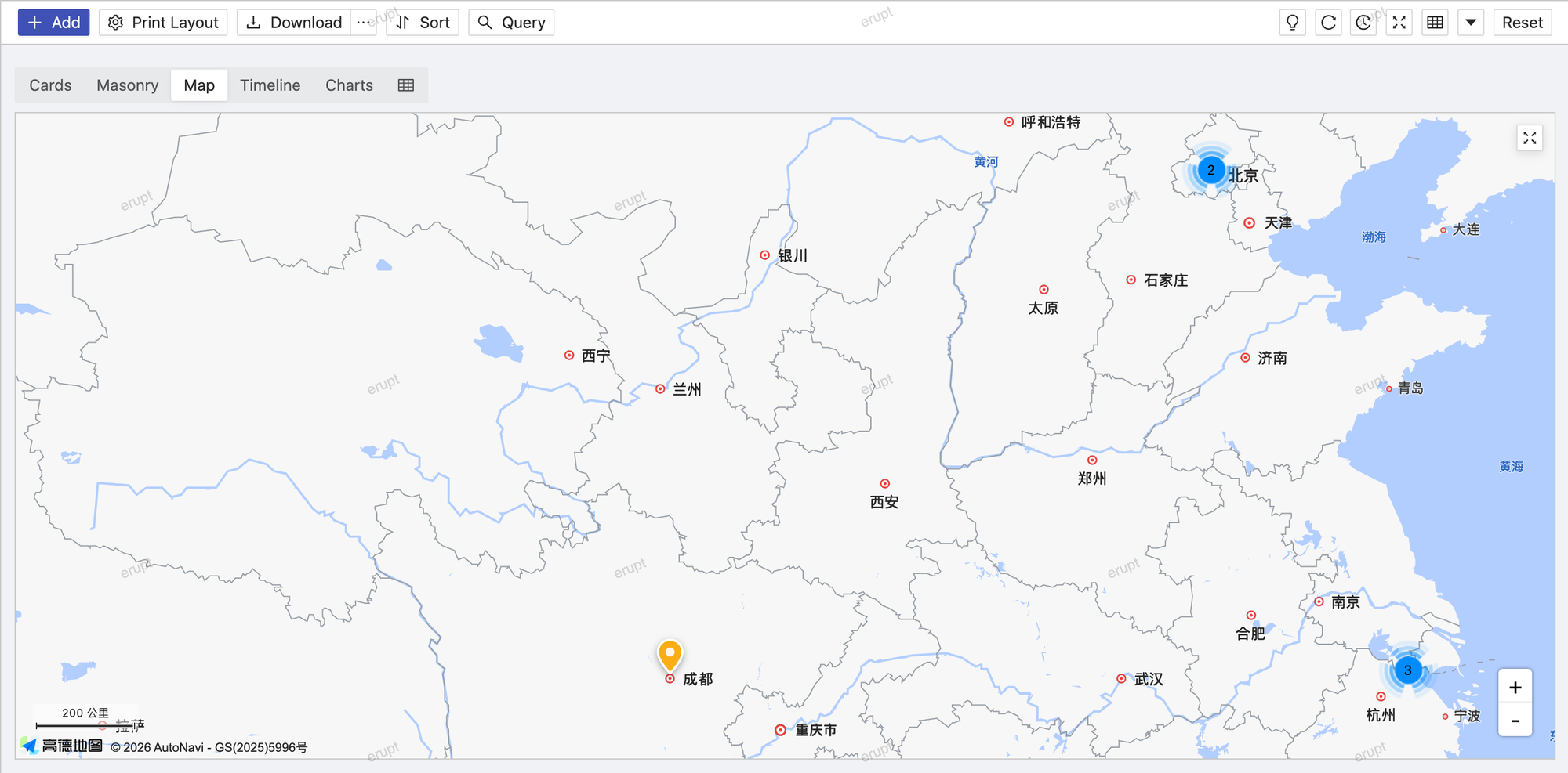
The map runs on AMap, Baidu, Tencent, Tianditu, Google or OpenStreetMap, picked in the frontend config; see Map Vendor Configuration.
Complete Example
@Entity
@Table(name = "t_store")
@Erupt(
    name = "Stores",
    visRawTable = true,
    vis = {
        @Vis(
            code = "map",
            title = "Map",
            type = Vis.Type.MAP,
            mapView = @MapView(locationField = "location", colorField = "color")
        )
    }
)
public class Store extends BaseModel {

    @EruptField(
        views = @View(title = "Store Name"),
        edit = @Edit(title = "Store Name", notNull = true)
    )
    private String name;

    @Column(length = 500)
    @EruptField(
        views = @View(title = "Location", type = ViewType.MAP),
        edit = @Edit(title = "Location", type = EditType.MAP)
    )
    private Location location;

    @EruptField(
        views = @View(title = "Color"),
        edit = @Edit(title = "Color", type = EditType.COLOR)
    )
    private String color;

}
Without an EditType.MAP field, two numeric fields can supply the coordinates instead:
@Vis(
    title = "Map",
    type = Vis.Type.MAP,
    mapView = @MapView(lngField = "lng", latField = "lat")
)
@MapView Attributes
public @interface MapView {

    String locationField() default ""; // EditType.MAP field; empty uses lngField / latField

    String lngField() default "";      // longitude field

    String latField() default "";      // latitude field

    String colorField() default "";    // hex color field for the marker

    boolean cluster() default true;    // merge nearby markers into clusters while zoomed out

}| Attribute | Description |
|---|---|
locationField | Name of the EditType.MAP field whose value (Location JSON) carries lng / lat; when empty, lngField / latField are used instead |
lngField | Longitude field name, numeric, used together with latField |
latField | Latitude field name, numeric |
colorField | Optional. Hex color field name (e.g. #FF5733) for the marker |
cluster | Whether nearby markers are clustered, defaults to true; while zoomed out, several markers merge into one cluster showing their count |
Rendering Rules
- One marker per row; rows without a position are left off the map
- Clicking a marker opens an info window with the row's visible columns, and its "open" link opens the row for editing / viewing
- The map view loads the full result set at once and hides the pager; search conditions still apply
- Positions supplied through
lngField/latFieldalone are read as AMap GCJ-02 coordinates; for another coordinate system use aLocationfield and set itscrs
Map Vendor Configuration
The map view shares its frontend configuration with EditType.MAP fields, set in app.js under eruptSiteConfig.map:
window.eruptSiteConfig = {
    map: {
        provider: "amap",   // amap | baidu | tencent | tianditu | google | osm
        key: "xxx",
        securityJsCode: "xxx",            // amap only
        // mapId: "",                     // google only: Map ID required for advanced markers
        // darkStyleId: "",               // baidu / tencent: custom style id used in dark mode
        // tileUrl: "",                   // osm only: a custom XYZ tile url template
        // center: {lng: 116.4, lat: 39.9} // where an empty map opens
    }
}| provider | Vendor | Coordinate system |
|---|---|---|
amap | AMap (default) | GCJ-02 |
baidu | Baidu Maps | BD-09 |
tencent | Tencent Maps | GCJ-02 |
tianditu | Tianditu | WGS-84 |
google | Google Maps | WGS-84 |
osm | OpenStreetMap, no key needed | WGS-84 |
INFO
The legacy top-level amapKey / amapSecurityJsCode settings still work and are equivalent to provider: "amap"; the same keys inside the map block take precedence. Vendor SDKs are fetched from their CDNs at runtime, nothing is bundled.
Location Type
xyz.erupt.annotation.model.Location is the typed value of an EditType.MAP field, independent of the map vendor:
public class Location {

    private Double lng;      // longitude
    private Double lat;      // latitude
    private String name;     // place name as the vendor returned it
    private String address;
    private Crs crs = Crs.GCJ02;  // coordinate system the lng / lat pair is expressed in

    public enum Crs {
        GCJ02, // AMap, Tencent
        BD09,  // Baidu: a further offset on top of GCJ-02
        WGS84  // Google, OpenStreetMap, Tianditu: the GPS datum
    }

}crsnames the coordinate system of the pair; the frontend converts when the configured vendor uses another one, so switching vendors needs no data migrationerupt-data-jpaships an auto-appliedLocationConverterthat stores aLocationas JSON in a single string column; give the column room for a name and address, e.g.@Column(length = 500)- An
EditType.MAPfield previously declared asStringholds the very same JSON, so it can change toLocationwithout a migration; keeping it asStringalso still works - Values written before the field existed came from AMap and are read as
GCJ02
See Location Picker MAP for the EditType.MAP field itself.
Contributors
 YuePeng