
Geographic Location MAP
A map point-selection component. Users click on a map to pick a place. The field can be a String (holding JSON text) or, since 2.4.0, the Location type; the map vendor is chosen in the frontend config and defaults to Amap (AutoNavi).
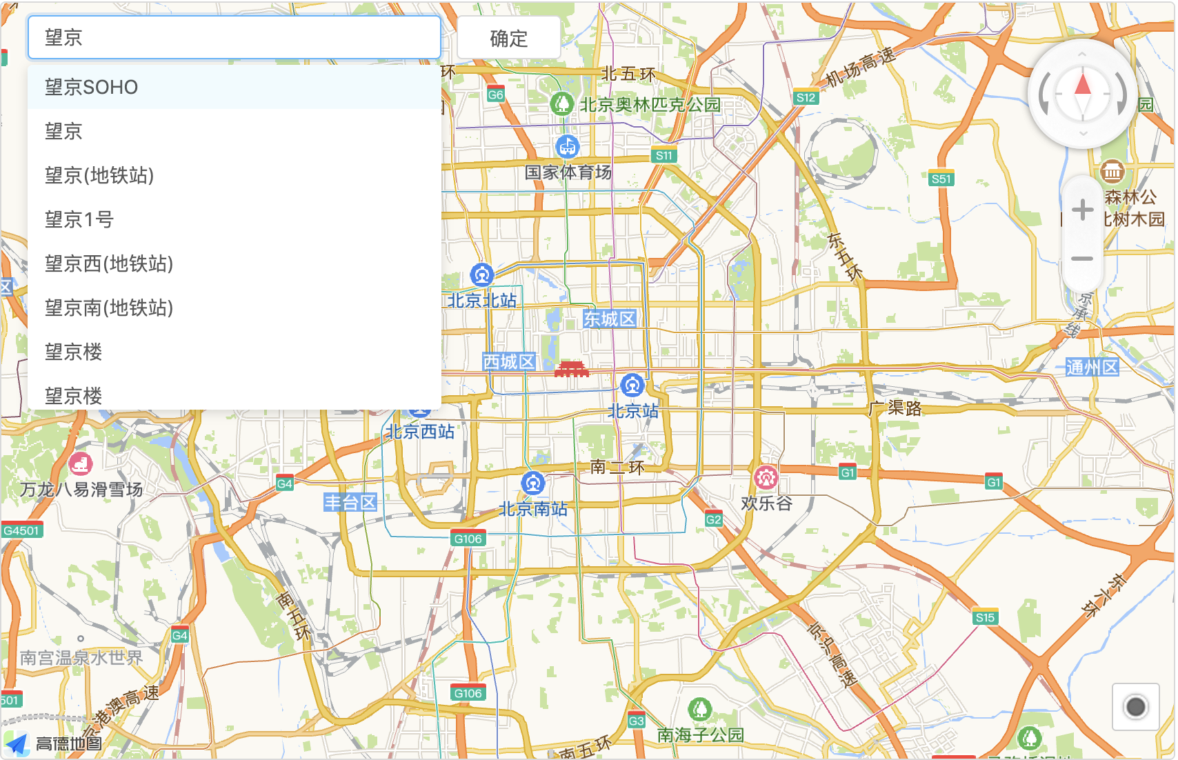
Basic Usage
@EruptField(
    views = @View(title = "Location", type = ViewType.MAP),
    edit = @Edit(title = "Location", type = EditType.MAP)
)
private String location;
Configuration
EditType.MAP has no dedicated @Edit sub-annotation. Declaring type = EditType.MAP is all that is required; there are no configuration options.
Constraints (from the MAP declaration in EditType):
- The field type is
Stringorxyz.erupt.annotation.model.Location(2.4.0+) - Excel import/export is not supported (
excelOperator = false) - For list display, pair it with
@View(type = ViewType.MAP); for a full-page map see the MAP view
The Location Type v2.4.0+
Since 2.4.0 the field can be declared as xyz.erupt.annotation.model.Location, so there is no JSON string to parse by hand:
public class Location {

    private Double lng;      // longitude
    private Double lat;      // latitude
    private String name;     // place name as the vendor returned it
    private String address;
    private Crs crs = Crs.GCJ02; // coordinate reference system

    public enum Crs {
        GCJ02, // AMap, Tencent
        BD09,  // Baidu: a further offset on top of GCJ02
        WGS84  // Google, OpenStreetMap, Tianditu: the GPS datum
    }

}@Column(length = 500) // room for the name and address
@EruptField(
views = @View(title = "Location", type = ViewType.MAP),
edit = @Edit(title = "Location", type = EditType.MAP)
)
private Location location;erupt-data-jpaauto-appliesLocationConverter, which stores aLocationas JSON text in one column, the same text aStringfield holds, so an existingStringfield can switch toLocationwithout a migrationcrsnames the coordinate system of the lng/lat pair and defaults toGCJ02; rows written by AMap before 2.4.0, which carry nocrs, are read asGCJ02- In code, read the coordinates straight from
location.getLng()/getLat()
Map Vendors v2.4.0+
The vendor is configured under eruptSiteConfig.map in the frontend app.js: amap, baidu, tencent, tianditu, google or osm (OpenStreetMap, no key needed):
window.eruptSiteConfig = {
    map: {
        provider: "amap",
        key: "your_map_key",
        securityJsCode: "your_security_code", // amap only
        // mapId: "",       // google only: the map ID advanced markers require
        // darkStyleId: "", // baidu / tencent: a custom style id used while the dark theme is on
        // tileUrl: "",     // osm only: an XYZ tile url template replacing OpenStreetMap's
        // center: {lng: 116.4, lat: 39.9}, // where an empty map opens
    },
};
The frontend converts between the configured vendor's coordinate system and Location.crs, so GCJ02 points saved in the AMap days still land in the right place after switching to Google or Tianditu, and vice versa.
TIP
The legacy top-level amapKey / amapSecurityJsCode still work and mean provider: "amap"; a value under map takes precedence.
Contributors
 YuePeng